Home / Maps & Images
Historical Maps & Images
21 maps and images — colonial-era tribal territory maps, Sanborn fire insurance surveys, and pages from primary source books. All public domain.
Frontispiece of Indian Paths showing trail map of greater New York area
bolton_1922_frontispiece.jpg · Full size →
Page from Bolton 1922 showing indigenous trail routes through Westchester
bolton_1922_p10.jpg · Full size →
Page from Bolton 1922 with trail descriptions near Croton area
bolton_1922_p25.jpg · Full size →
Title page of Indian Paths in the Great Metropolis by Reginald Bolton 1922
bolton_1922_title.jpg · Full size →
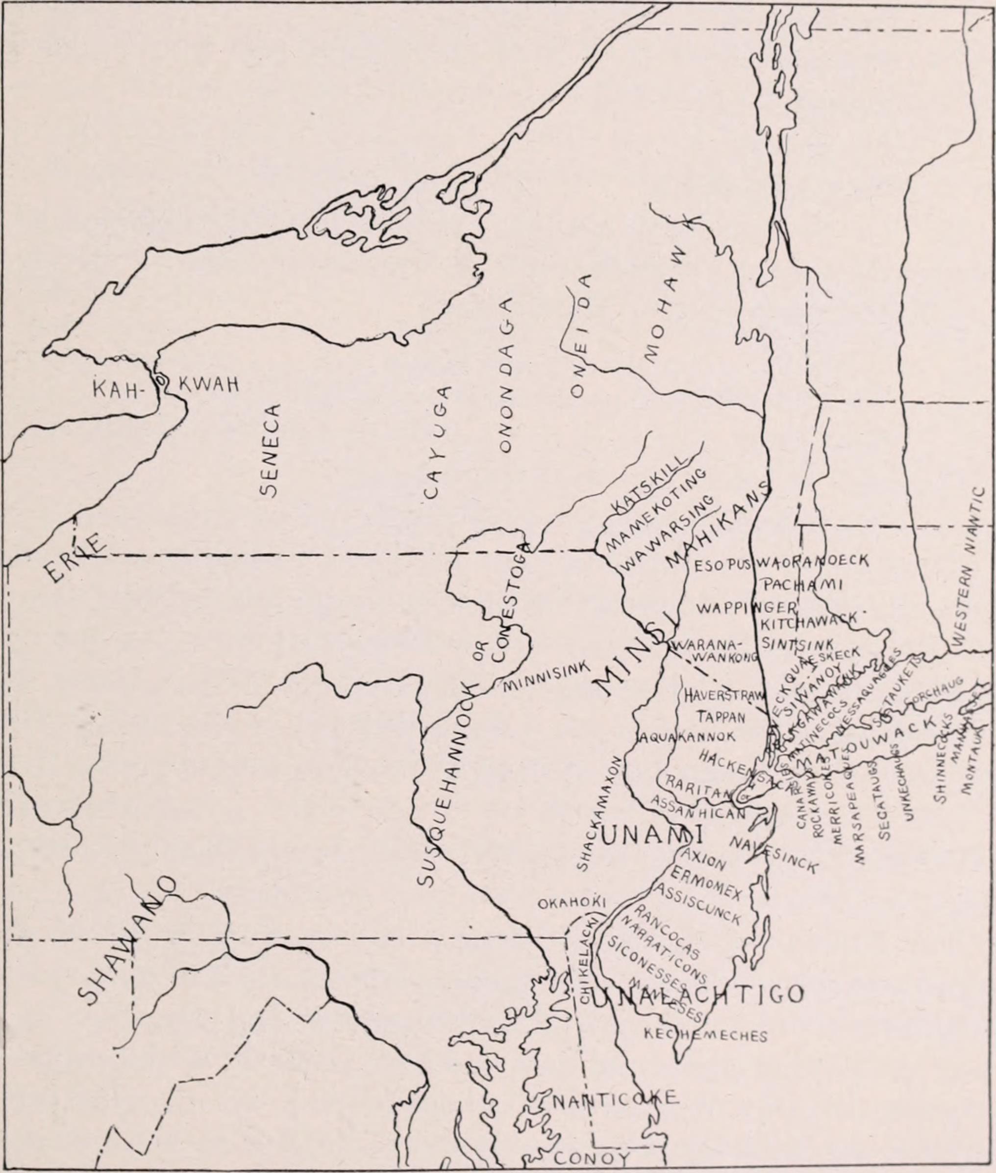
1921 map of Indian tribes in the vicinity of Manhattan including Kitchawank
indians_manhattan_vicinity_1921.jpg · Full size →
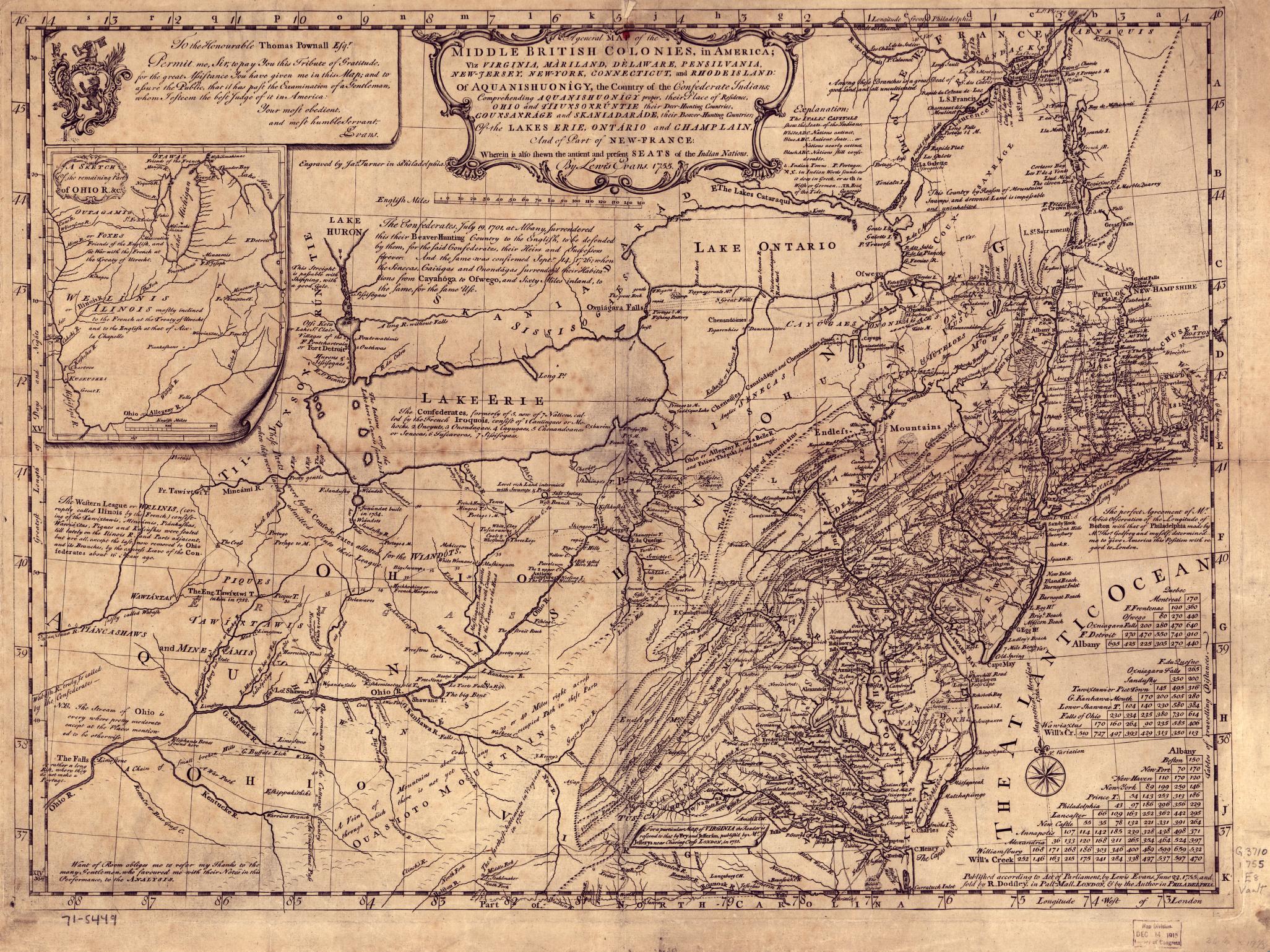
Mitchell 1755 map of Middle British Colonies including Westchester County
mitchell_1755_middle_colonies_med.jpg · Full size →
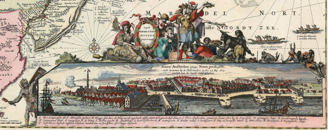
Detail of Allard map showing indigenous settlements along the Hudson River
neobelgii_allard_detail.png · Full size →
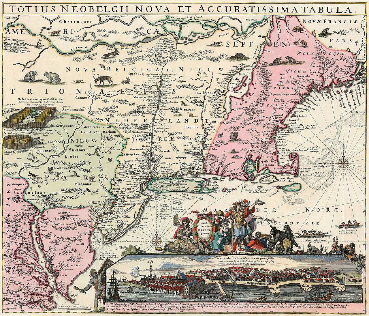
Allard Ottens 1662 map of New Belgium showing Kitchawank territory near Croton
neobelgii_allard_ottens_1662.jpg · Full size →
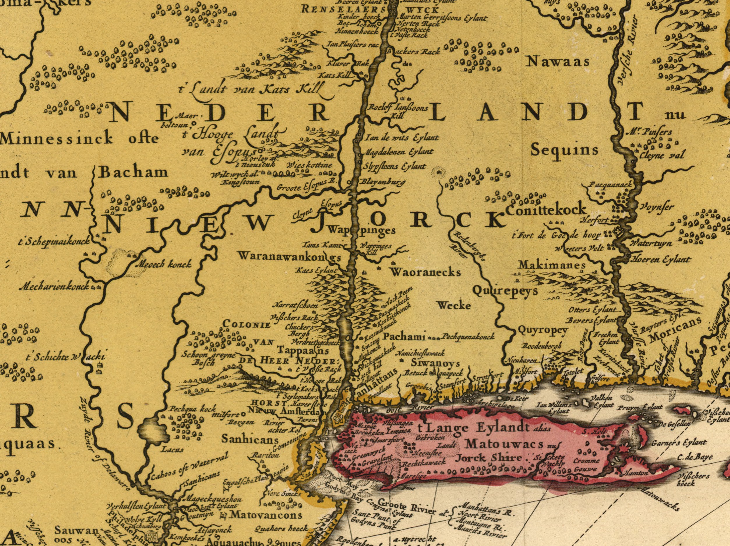
Novi Belgii Novaeque Angliae 1685 map detail showing Indian settlements in Westchester County
novi_belgii_1685_excerpt.jpg · Full size →
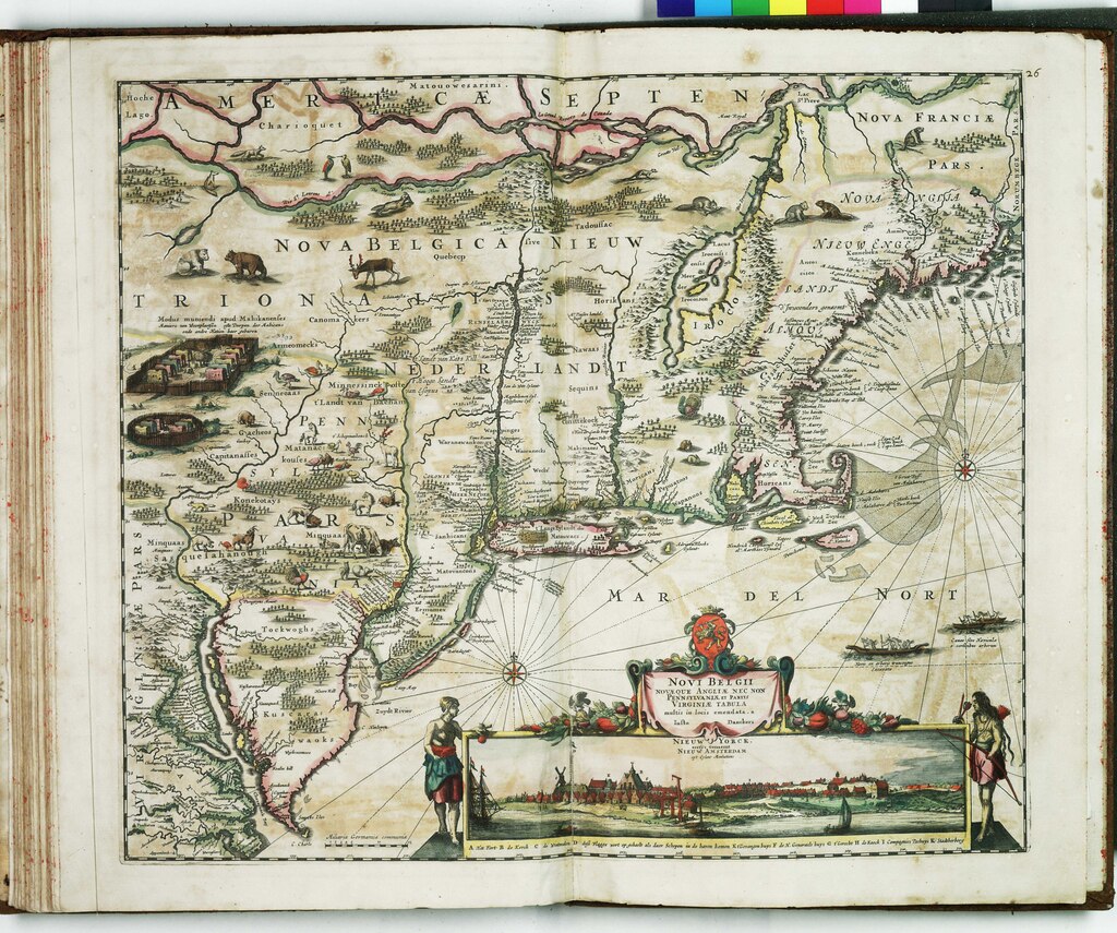
Visscher map of New Netherland showing Dutch colonial settlements and Native American territories
novi_belgii_visscher_rmg.jpg · Full size →
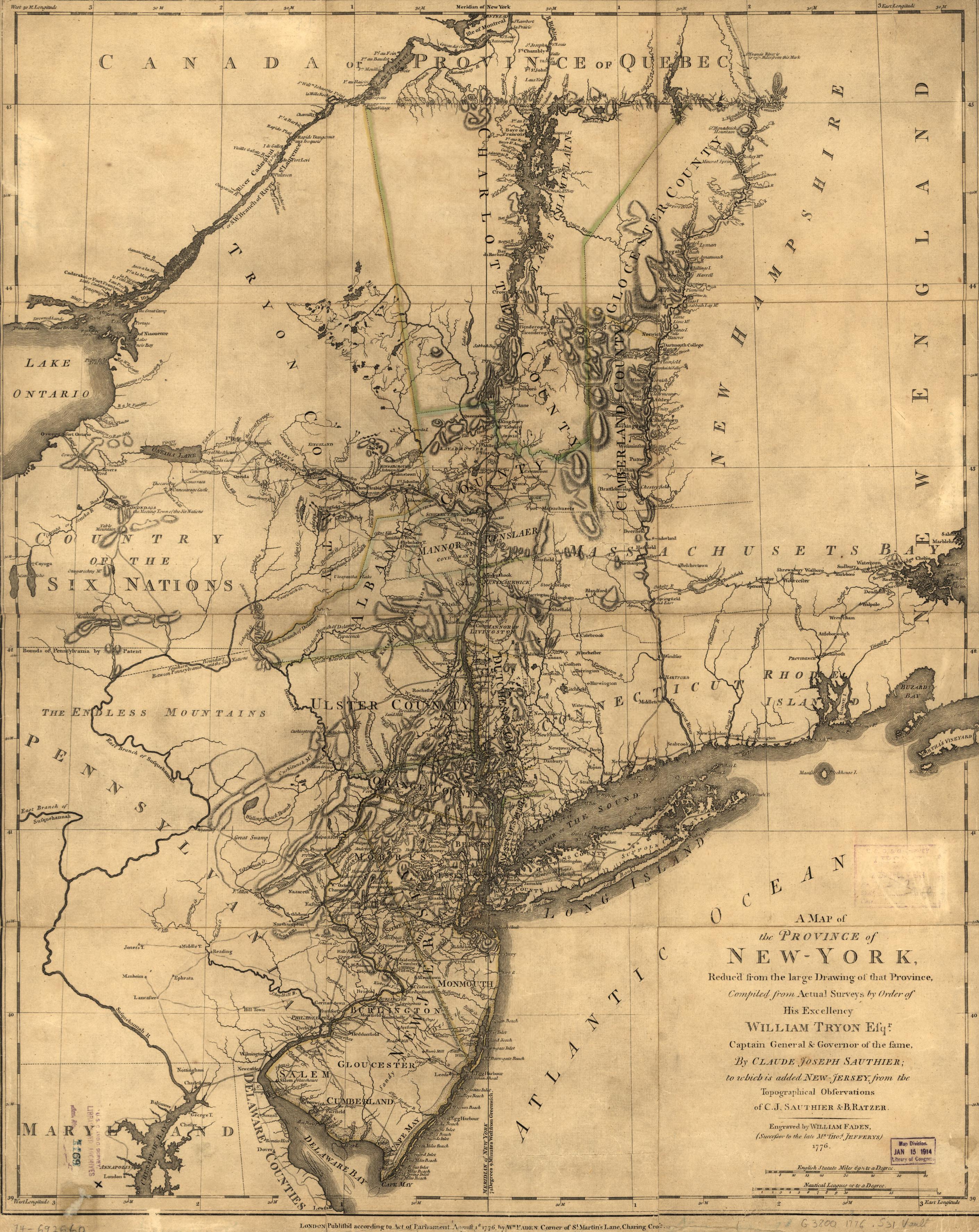
1776 Province of New York map during Revolutionary War era
ny_province_1776_map.jpg · Full size →

Title page of History of Indian Tribes of Hudsons River by Ruttenber 1872
ruttenber_1872_p0001_title.jpg · Full size →

Page from Ruttenber 1872 describing Kitchawank and Wappinger tribes
ruttenber_1872_p0007.jpg · Full size →
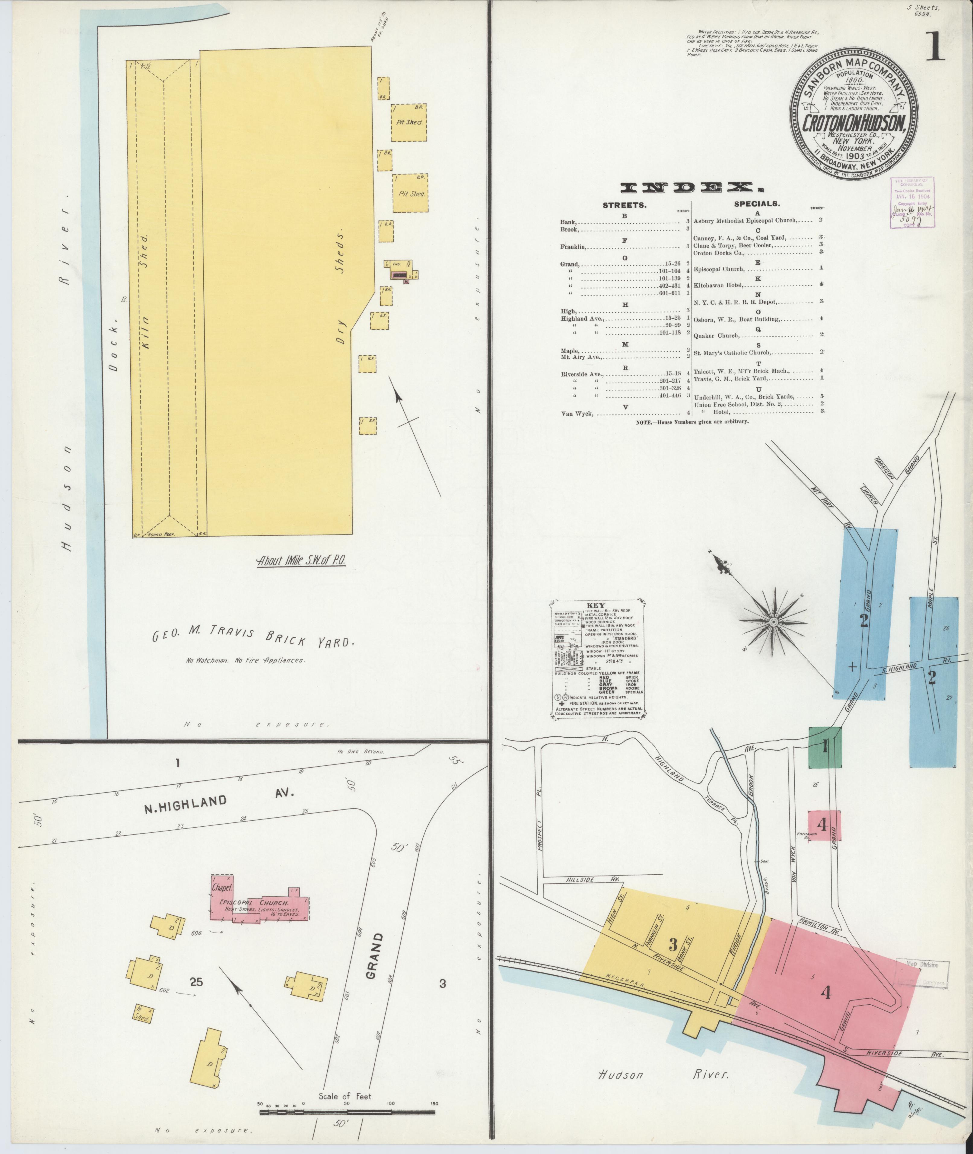
Sanborn fire insurance map of Croton-on-Hudson 1903 showing village layout
sanborn_croton_1903_p1.jpg · Full size →
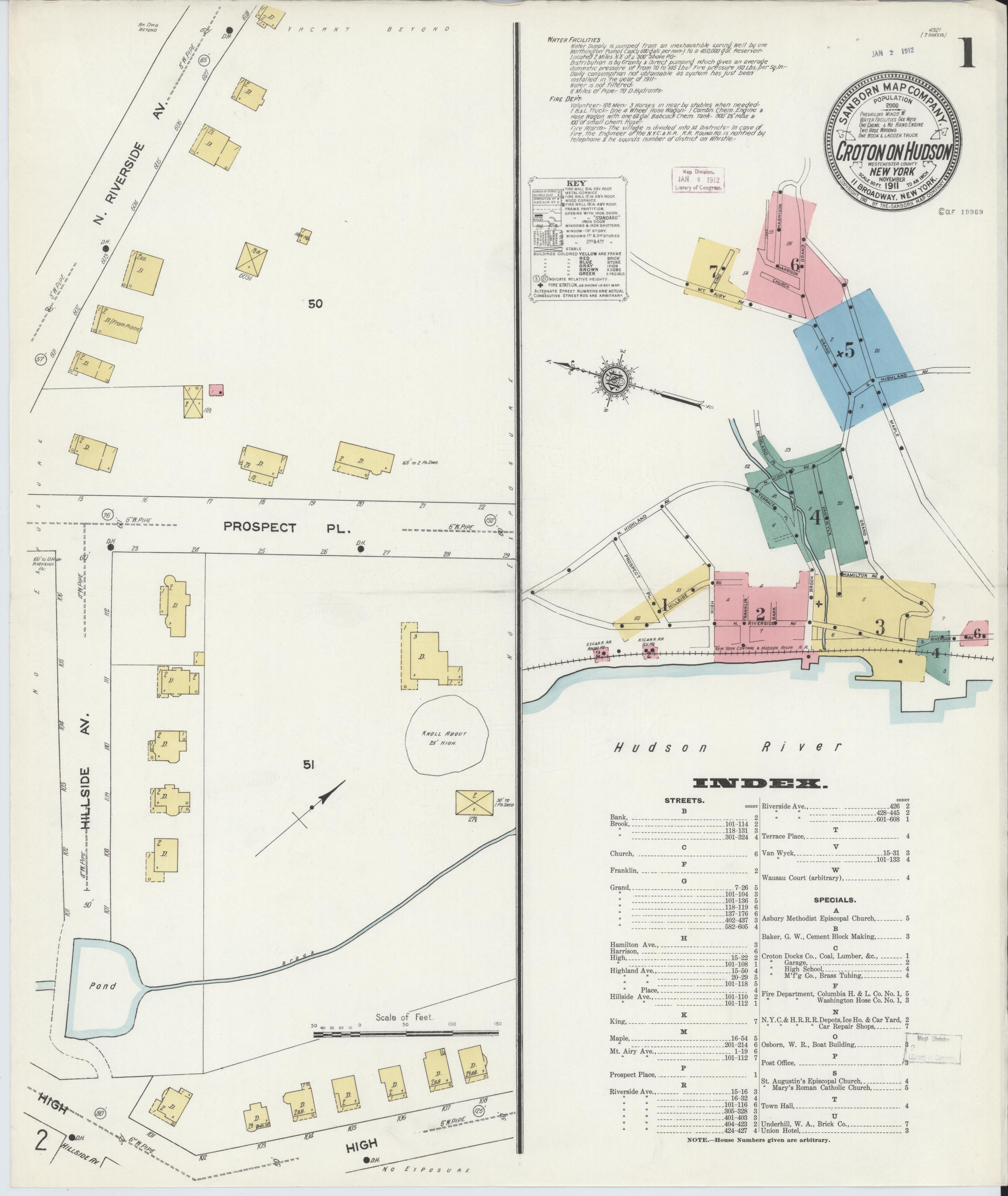
Sanborn fire insurance map of Croton-on-Hudson 1911
sanborn_croton_1911_p1.jpg · Full size →
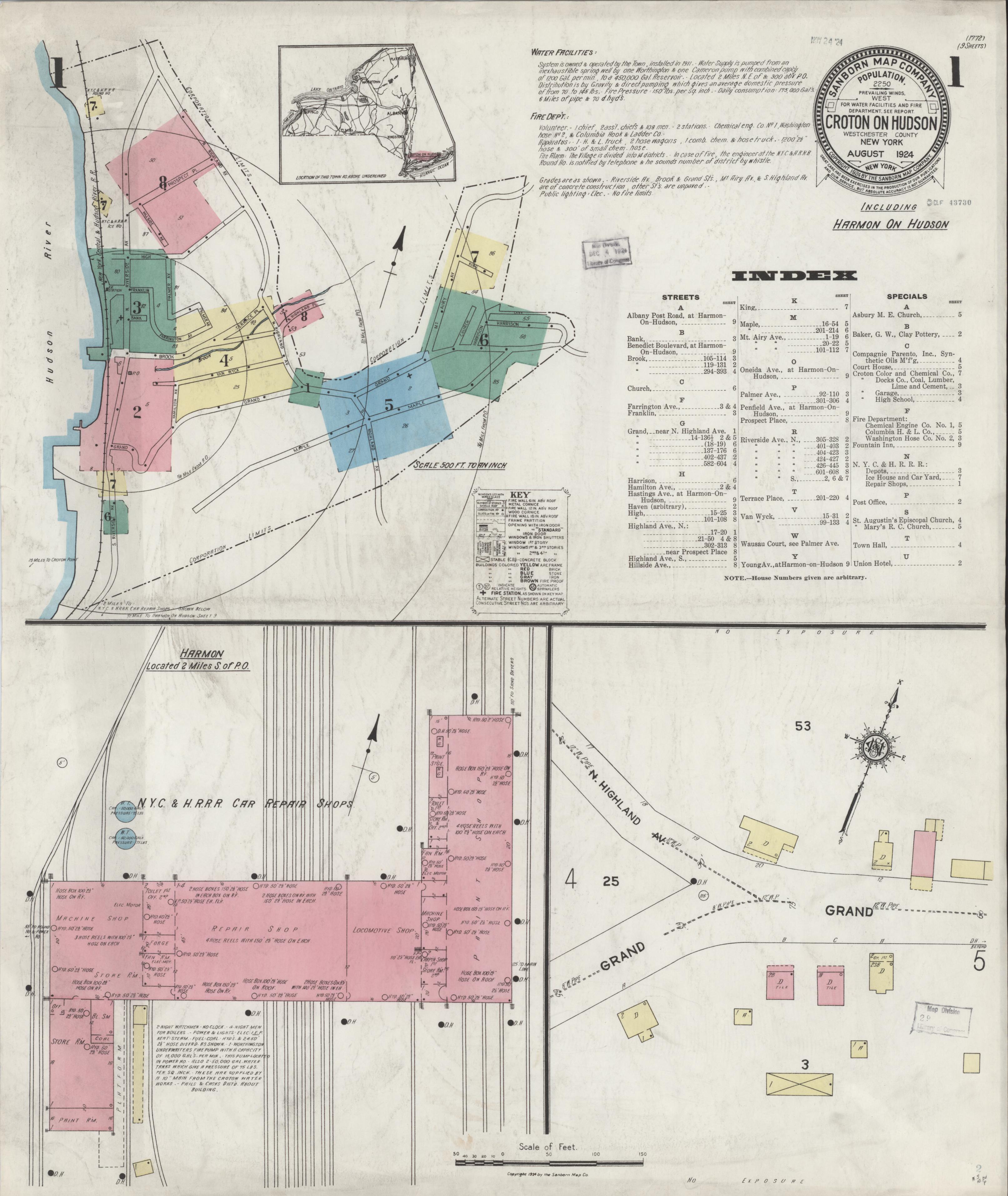
Sanborn fire insurance map of Croton-on-Hudson 1924 sheet 1
sanborn_croton_1924_p1.jpg · Full size →
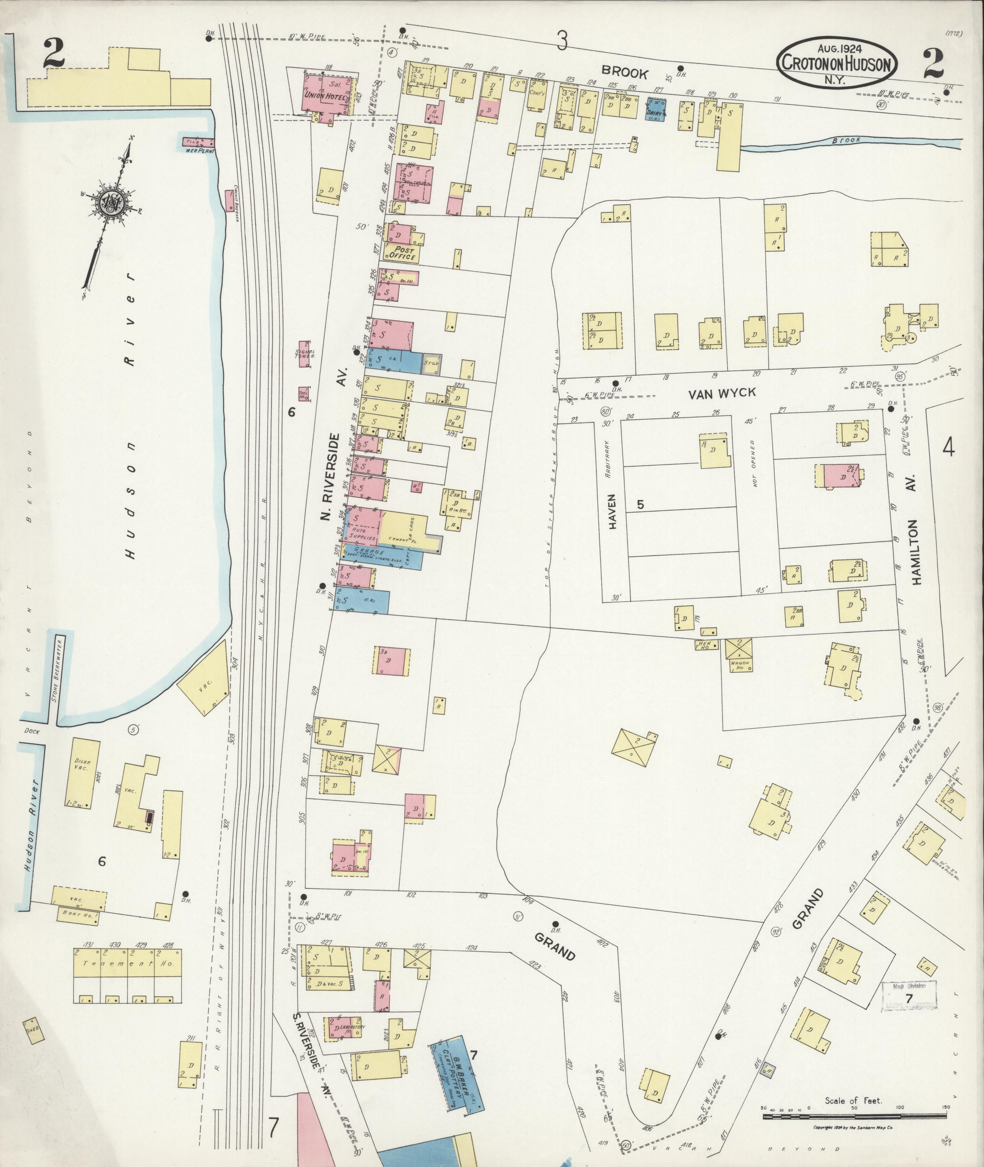
Sanborn fire insurance map of Croton-on-Hudson 1924 sheet 2
sanborn_croton_1924_p2.jpg · Full size →
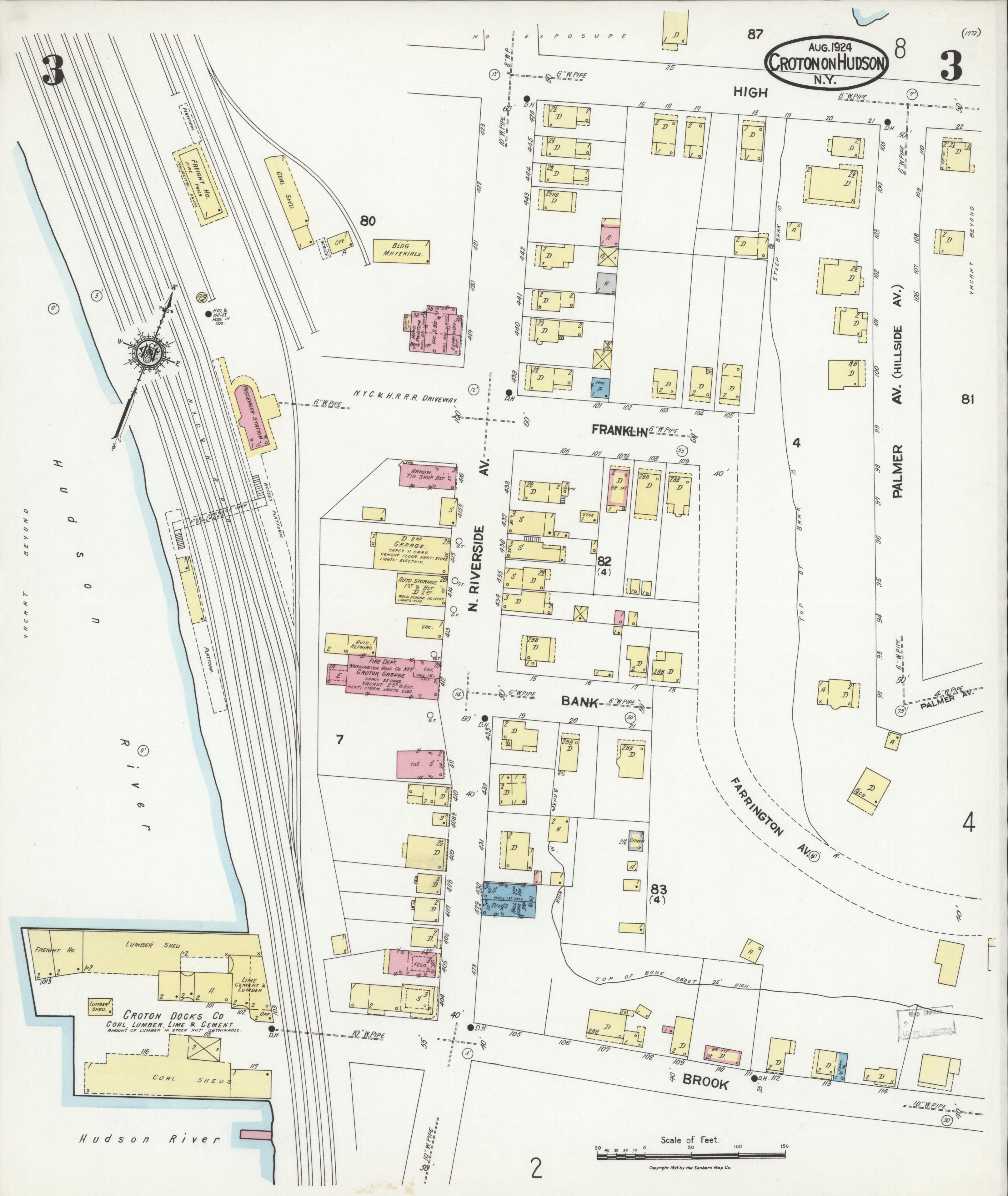
Sanborn fire insurance map of Croton-on-Hudson 1924 sheet 3
sanborn_croton_1924_p3.jpg · Full size →
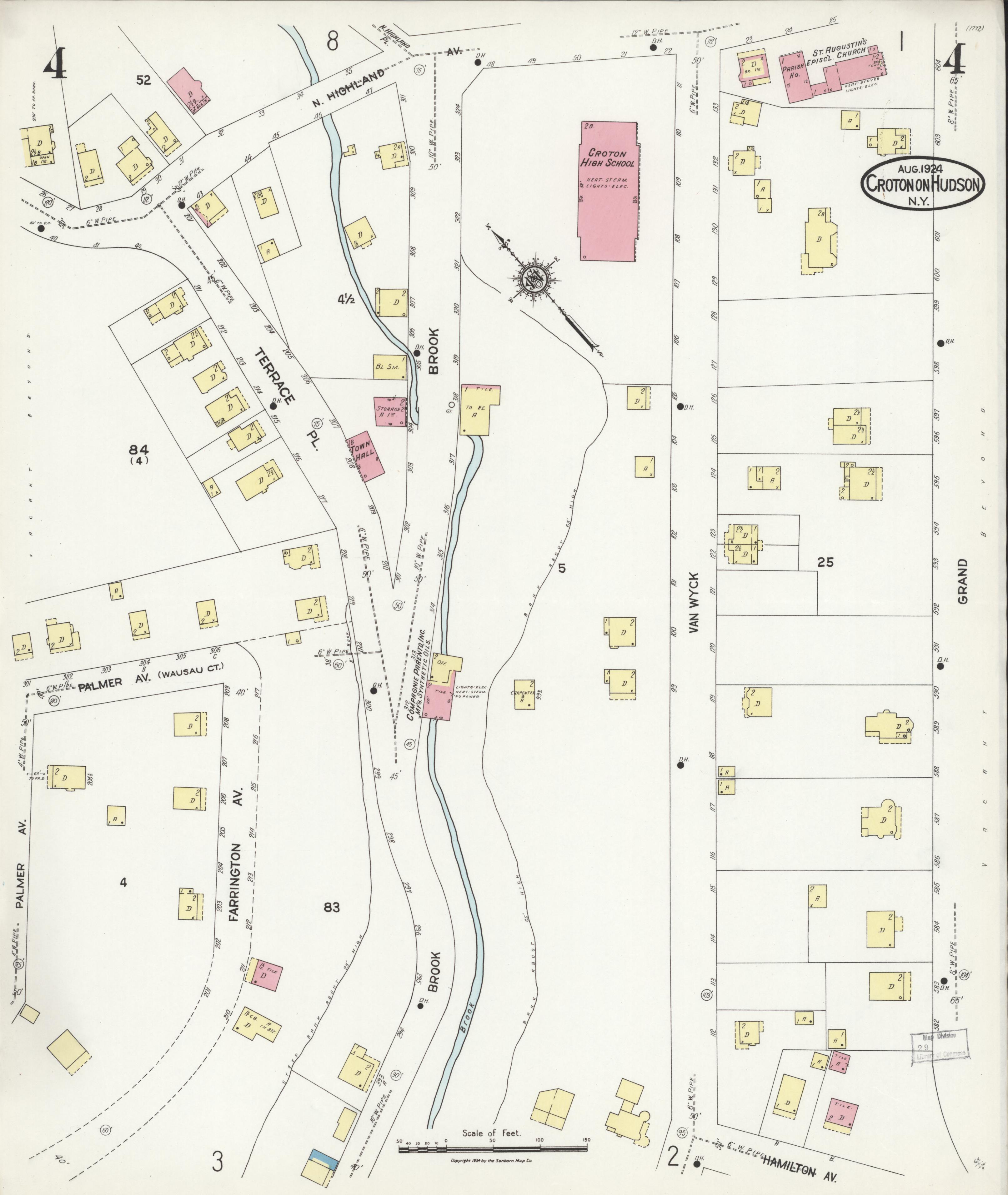
Sanborn fire insurance map of Croton-on-Hudson 1924 sheet 4
sanborn_croton_1924_p4.jpg · Full size →
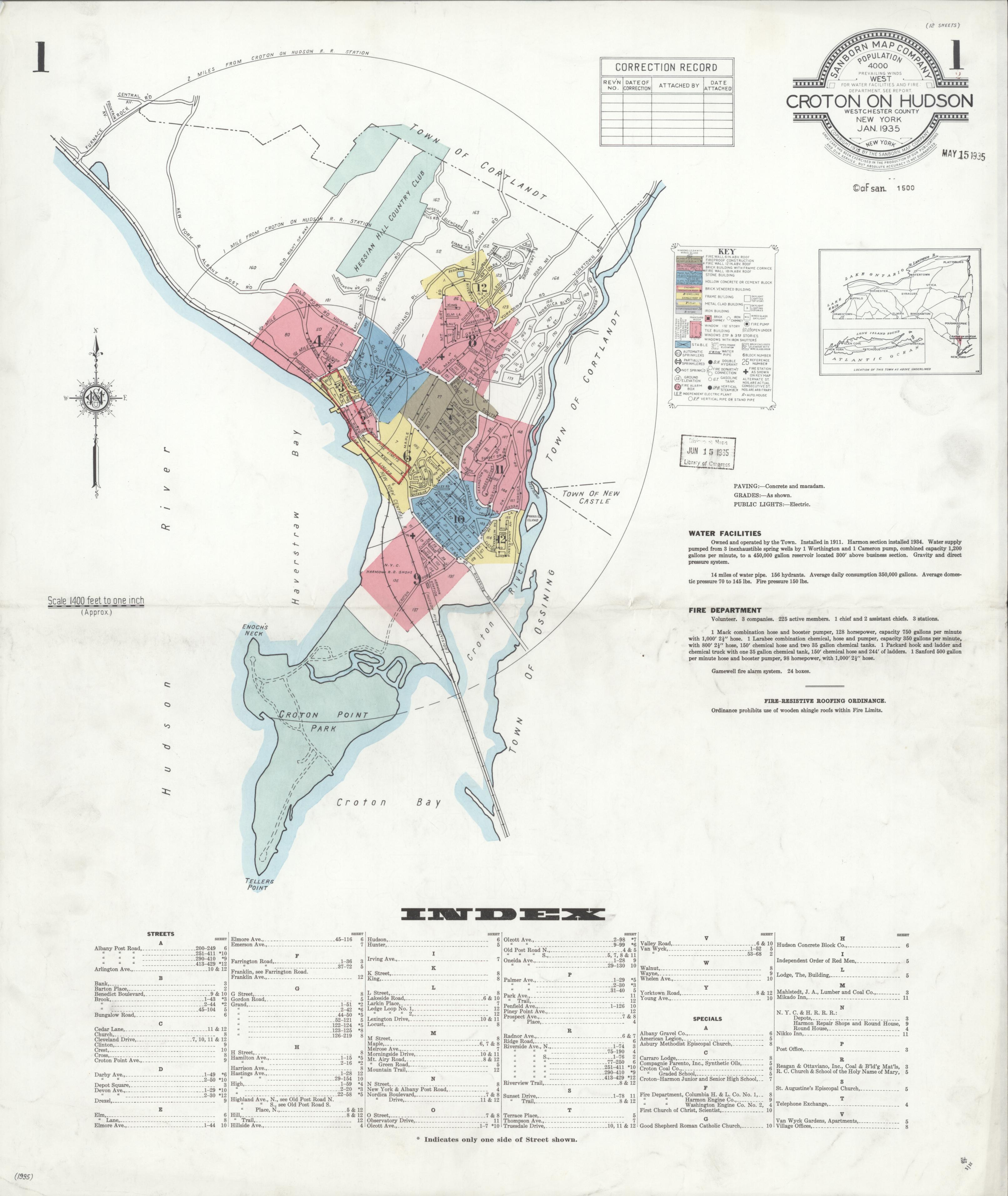
Sanborn fire insurance map of Croton-on-Hudson 1935
sanborn_croton_1935_p1.jpg · Full size →
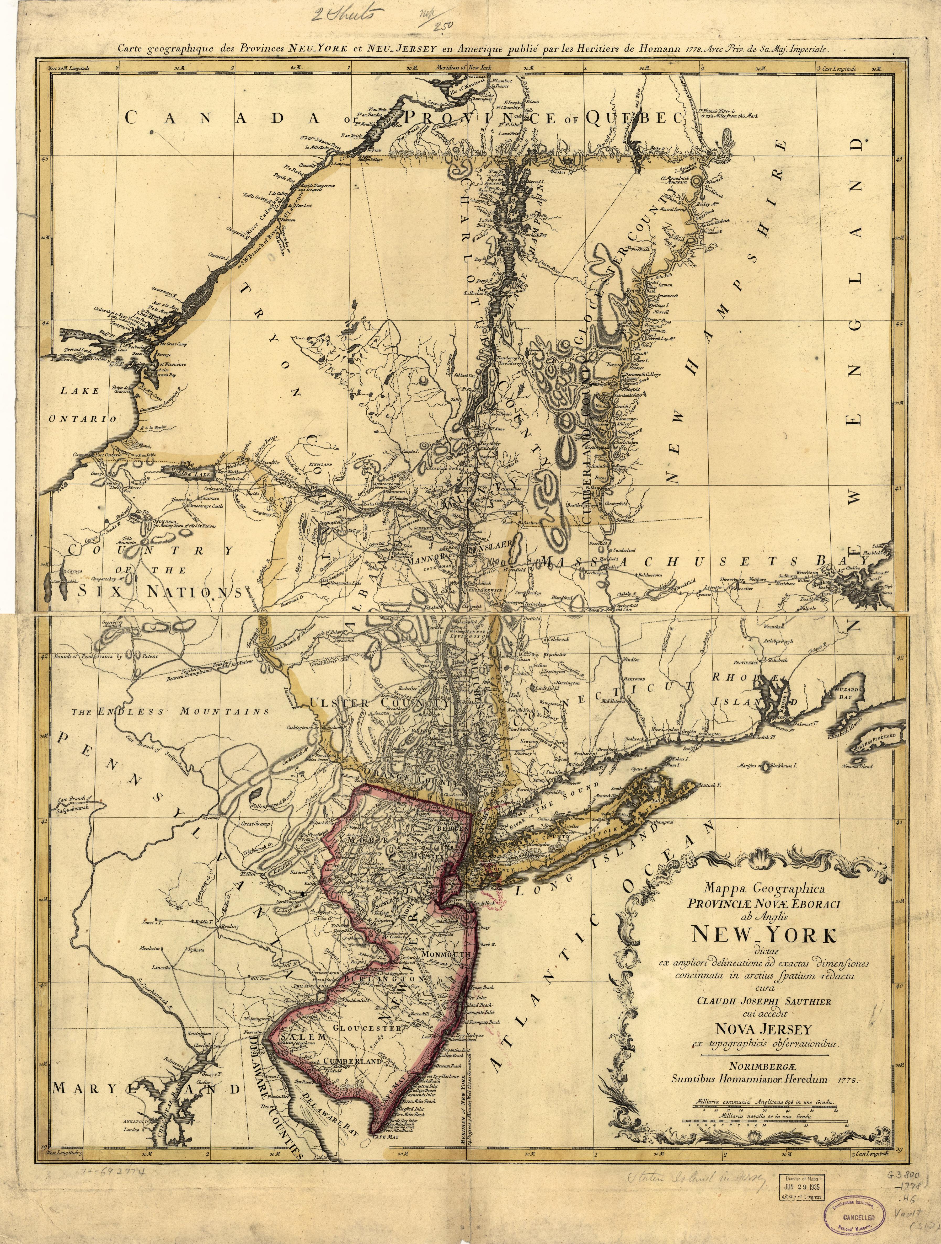
Sauthier 1778 Province of New York map showing Westchester County and Cortlandt Manor
sauthier_1778_ny_province.jpg · Full size →