Home / Search
99 results for "Below the Dam"
Filter:
All
· 🏹 Indigenous Peoples & Archaeology
· 📜 Colonial & Dutch Records
· 📖 Westchester County Histories
· 🏘️ Croton Local History
· 🏛️ Government Documents
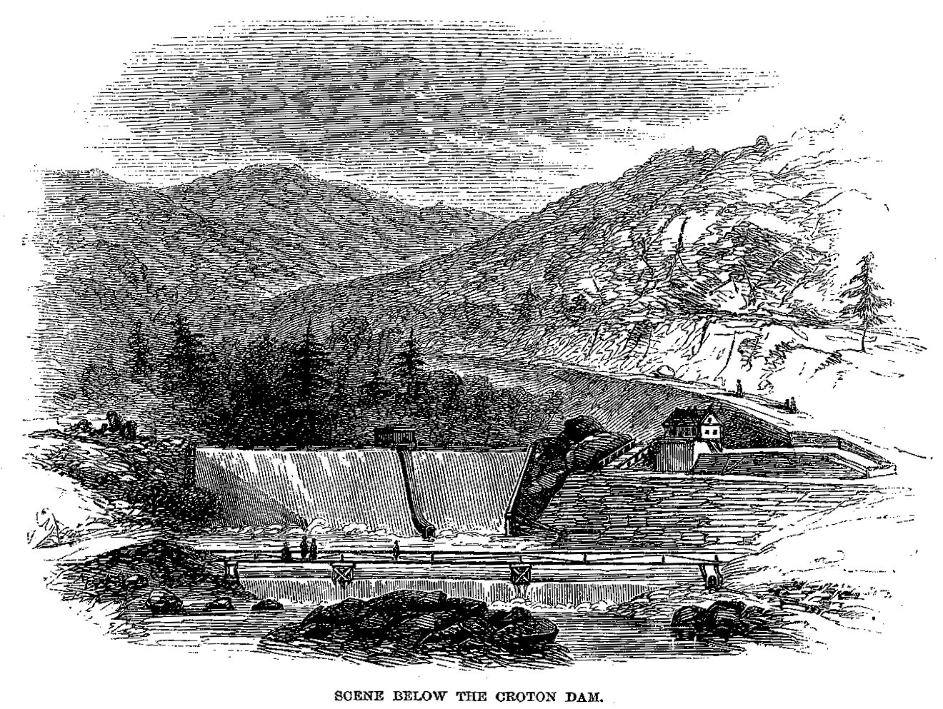
Harper's New Monthly Magazine / Wikimedia Commons
Scene Below the Croton Dam — Harper's Magazine (1860)
Engraving from T. Addison Richards' article 'The Croton Aqueduct' in Harper's New Monthly Magazine, December 1860. Shows the dramatic scenery below the Old Croton Dam with water cascading over the…
J. Thomas Scharf (1886)
— source
— 📕 Full PDF
…According to the plan recently adopted, a dam is to be built at Quaker Bridge, about two and a half miles below the present dam, to be about two hundred feet in height above the level of the Hudson River…
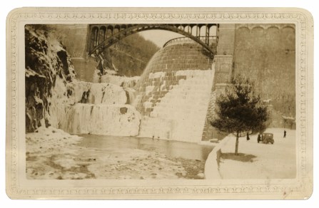
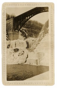
crotonhistory.org — https://crotonhistory.org/2015/12/05/visit-to-new-croton-dam-february-1934/
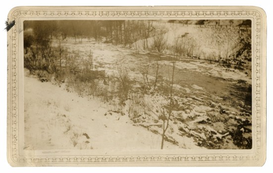
…One photograph shows the main dam structure, while another captures the spillway during the cold season. A third image documents ice accumulation on the spillway itself. Additional photographs depict the Croton River below the dam and ice-covered rocks positioned…
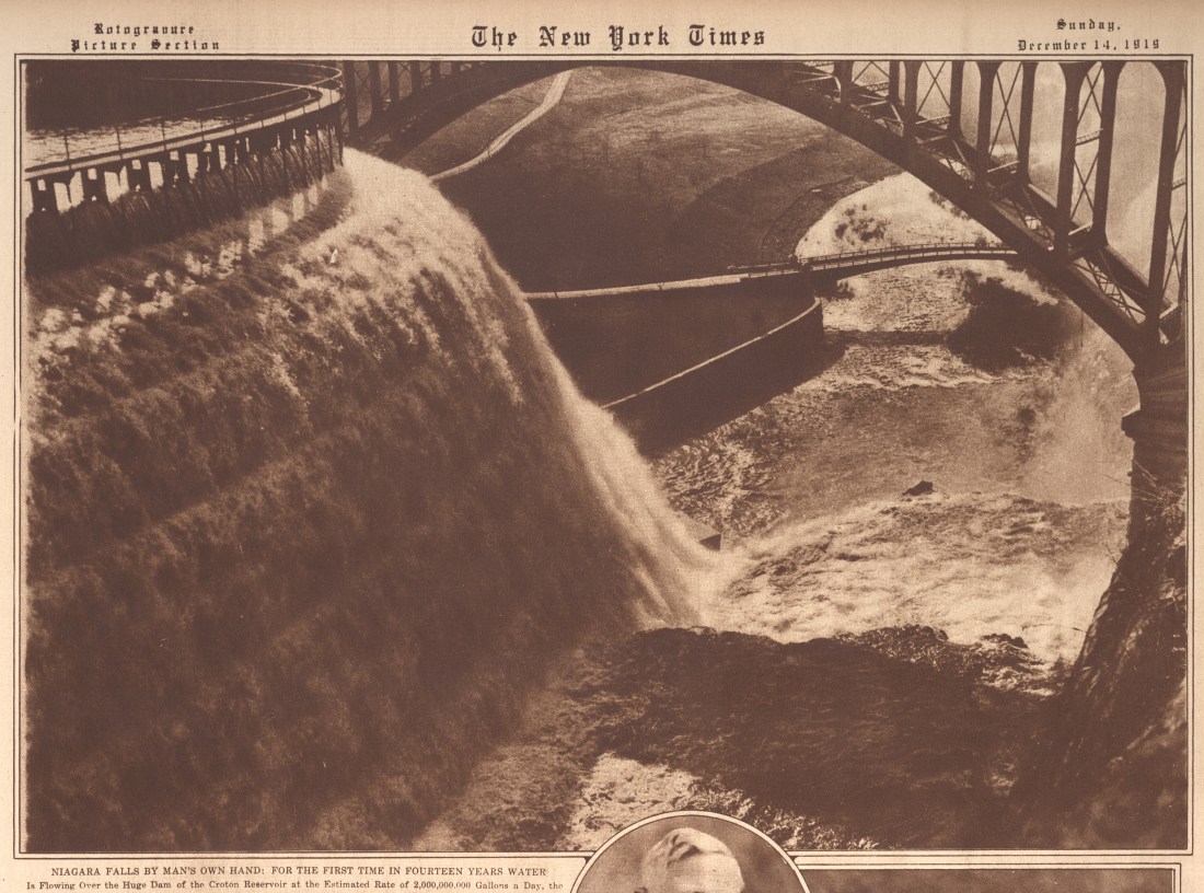
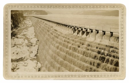
crotonhistory.org — https://crotonhistory.org/2016/02/17/niagara-falls-by-mans-own-hand/
…the first time in fourteen years water is flowing over the huge dam of the Croton Reservoir at the estimated rate of 2,000,000,000 gallons a day, the vast tide dropping to the Croton River, 150 feet below…
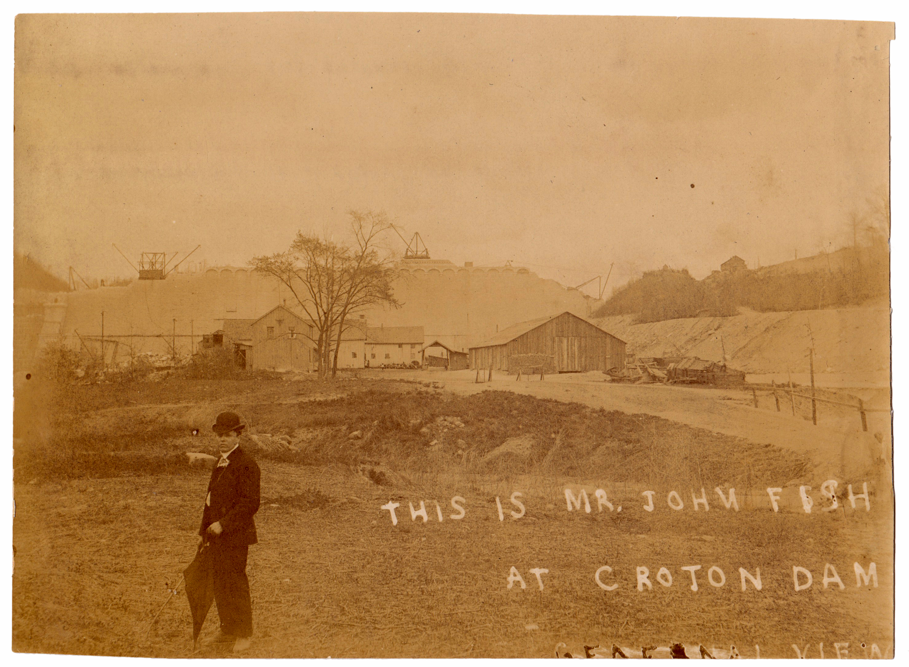
crotonhistory.org — https://crotonhistory.org/2015/08/27/new-croton-dam-construction-circa-1902/
…The images showcase substantial construction infrastructure, including machine shops positioned below the dam (now parkland), a temporary suspension bridge spanning the Croton River, and a house serving as the construction office. One particularly significant photograph provides "a rarely seen view…
king_memoir_1843_raw.txt
— 📕 Full PDF
…Albert Brayton, the son of one of the dam contractors, perceiving about one o'clock, the danger to the people below the dam on the opposite side, by the continued rise of the water at the dam, and believing that…
Croton Friends of History — https://www.crotonfriendsofhistory.org/the-great-freshet
…All bridges below the dam were carried away, leaving no bridge over the Croton from its mouth to Golden's Bridge, a distance of twelve to sixteen miles. The Bailey family published thanks on January 19, 1841, acknowledging neighbors including…
J. Thomas Scharf (1886)
— source
— 📕 Full PDF
…Just below the southern end of the dam is the pretty stone gate-house, through which the water is admitted to the aqueduct, and started on its mission of useful-ness to the city. A short distance below is the…
Edward Manning Ruttenber (1906)
— source
— 📕 Full PDF
…On the northwestern bank of Murderers' Creek, about half a mile below Washingtonville, stands the dwelling-house of Henry Page (a colored man), said to be the site of Maringoman's wigman, referred to in the Van Dam Patent of…
king_memoir_1843_raw.txt
— 📕 Full PDF
…At 300 feet below the main dam, a second dam is in progress, which is to be 9 feet high, constructed of timber, stone and gravel, which will set the water back over the apron of the main dam, and…
Wikipedia
…Labor disputes arose, documented in the 1900 film "The Croton Dam Strike."
At completion in 1906, the dam became the tallest dam in the world. Its foundation extends 130 feet below the riverbed, containing 850,000 cubic yards of masonry…
NYPL, Illustrations of the Croton Aqueduct (F.B. Tower)
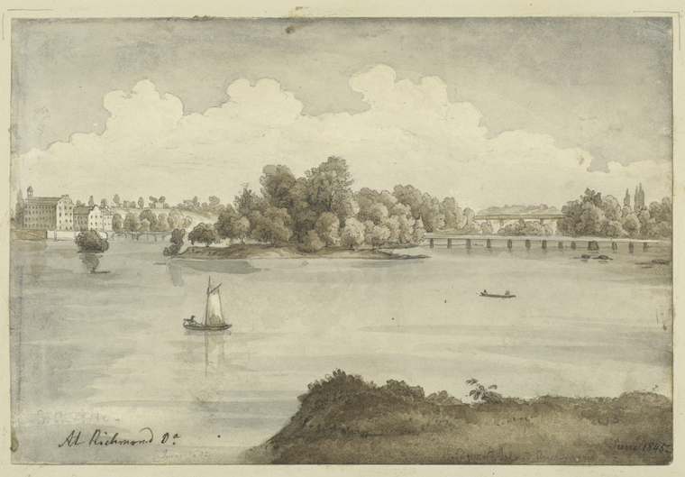
View of Richmond, Virginia
A serene landscape drawing of a river scene with a sailboat and a rowboat, featuring buildings and trees along the shoreline, with a bridge in the distance.
Date: 1843
Location: Croton-on-Hudson, NY
Type: drawing…
illustrations_aqueduct_raw.txt
— 📕 Full PDF
…is a view taken from a point below the dam and shows the relative positions of the dam and the gate chamber at the head of the Aqueduct. The original channel of the River where the dam is built, X…
Various (1971)
— source
…Since both of these sites lay below the proposed flood level of the river it was decided to excavate them before the completion of the dam. The Witchs Walk Sites, as they came to be called, are located on the…
illustrations_aqueduct_raw.txt
— 📕 Full PDF
…This dam was proposed to be built about 2 feet above the level of high tide, thereby keeping all the salt water below ; and above the dam would be the fresh water for supplying the city, which must be pumped…
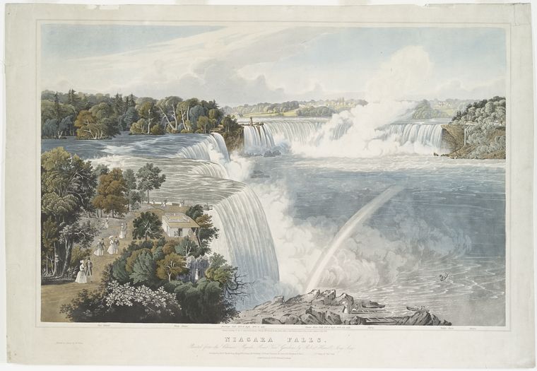
NYPL, Illustrations of the Croton Aqueduct (F.B. Tower)
…A rainbow is visible in the mist below the main waterfall. In the foreground, people are standing on a path overlooking the falls.
Date: 1843
Location: Croton-on-Hudson, NY
Type: lithograph
Subjects: waterfalls, rainbow, trees, people
Text visible in…
Croton Friends of History
…The New Croton Dam extended 1,168 feet across the valley with a 1,000-foot spillway. Foundation depth measured 131 feet below the riverbed, with total height reaching 297 feet, base thickness of 206 feet, and top thickness of…
Robert S. Grumet (2014)
…The name first appeared in its current form (see below), crosses Wayne Township’s central north-south axis. A local developer building a dam across Packanack Brook in 1928 NOMAHEGON (Union County). Today, Nomahegon is the name gave the name…
king_memoir_1843_raw.txt
— 📕 Full PDF
…the apron at the toe of the dam, and thereby breaking the force of the fall, by its action on a body of water, there has been constructed, at a point 300 feet below the main dam, a secondary dam…
Croton Friends of History
…The Dam Solution and Legal Victory
The village conducted geological surveys revealing underground water reserves approximately 30 feet below the riverbed. A breakthrough arrived in the early 1960s when the Hudson River Fishermen's Association won a lawsuit requiring NYC…
king_memoir_1843_raw.txt
— 📕 Full PDF
…These are all the losses which have come to our knowledge on the Crotori River, and all the losses to everybody above and below the dam, including the dam, are considerably inside of $75,000." No other parts of the…
king_memoir_1843_raw.txt
— 📕 Full PDF
…The line cuts a small section of marble of infe- rior quality, about two miles below the Croton dam. In running through the State farm at Sing Sing, it passes a few hundred feet (mostly by a tunnel) in a…
king_memoir_1843_raw.txt
— 📕 Full PDF
…the dam, yet we fear, that, in locking vessels up, more or less of the salt water below the dam will follow them, and although the quantity may be compara- tively small, the constant repetition of the operation, by the…
old_croton_aqueduct_raw.txt
— 📕 Full PDF
distance of about three miles carrying away m its course, Quaker bridge, Holman 's mills, and the old piers of the old Croton bridge.... All the bridges below the dam were carried away, and above the dam. Pines Bridge, and…
king_memoir_1843_raw.txt
— 📕 Full PDF
…The aqueduct proceeds from the Sing Sing tunnel, crossing both the aforesaid street and creek, from north to south. 3d. An archway over the Highland turnpike, now highway, about eleven miles below the Croton dam, of 20 feet span, and…
king_memoir_1843_raw.txt
— 📕 Full PDF
…Seymour is of opinion that no injury will be done to the land on the banks of the Hudson by the rise of water within the dam ; but, the Commissioners think, the rising of the water permanently, two feet above…
croton_waterworks_raw.txt
…Current Designation(s) Sign MUSCOOT DAM 1905 Plate 15-, New Croton Aqueduct Current Designation(s) MILL RIVER WASTE WEIR 1837-1841 Plate 22-6, Old Croton Aqueduct Spanning a depression 72 feet below grade, the Mill River Culvert’s 172…
old_croton_aqueduct_raw.txt
— 📕 Full PDF
…Ogee Shape of the Weir Overflow figure 25. below left: Lt. Theophilus Schramke. Croton Dam Design — Cross Section of Ogee Curve, engraving In Description of the Sen' York Croton Aqueduct in English, German and French, 1846 Courtesy William Lee Frost…
illustrations_aqueduct_raw.txt
— 📕 Full PDF
…The water is set back at this place by a dam for a mill a short distance below, giving the stream an appearance of more magnitude than it really possesses. This point is 25 miles from the dam. The wall…
croton_waterworks_raw.txt
…Type Significance(s) Interpretation Sign Current Designation(s) Interpretation Current Designation(s) AMAWALK GATEHOUSE 1889-1896 Plate 9-, New Croton Aqueduct Located south of the main dam, the gatehouse receives water from the tower and sends it to the fountain…