*No other site in the Hudson Valley compresses so much history into so small a space — a peninsula that has been a fortress, a colonial purchase, a vineyard, a brickyard, and a landfill, all on the same ground*
Croton Point is a broad peninsula that extends a mile into the Hudson River, separating Tappan Bay from Haverstraw Bay. It is a geological anomaly — a mass of clay and sand thrust into the river by glacial action — and it has attracted human settlement for at least seven thousand years. Benson Lossing, visiting in the 1850s, described it as stretching "nearly two miles" and noted that it was "originally called Se-nas-qua by Native Americans" (chunk 963, crotonhistory.org). Today it is a 508-acre county park (Wikipedia, chunk 728). Between those two descriptions lies an extraordinary succession of uses, each one burying the last.
First Life: The Kitchawank Village (c. 5000 BC – 1680s)
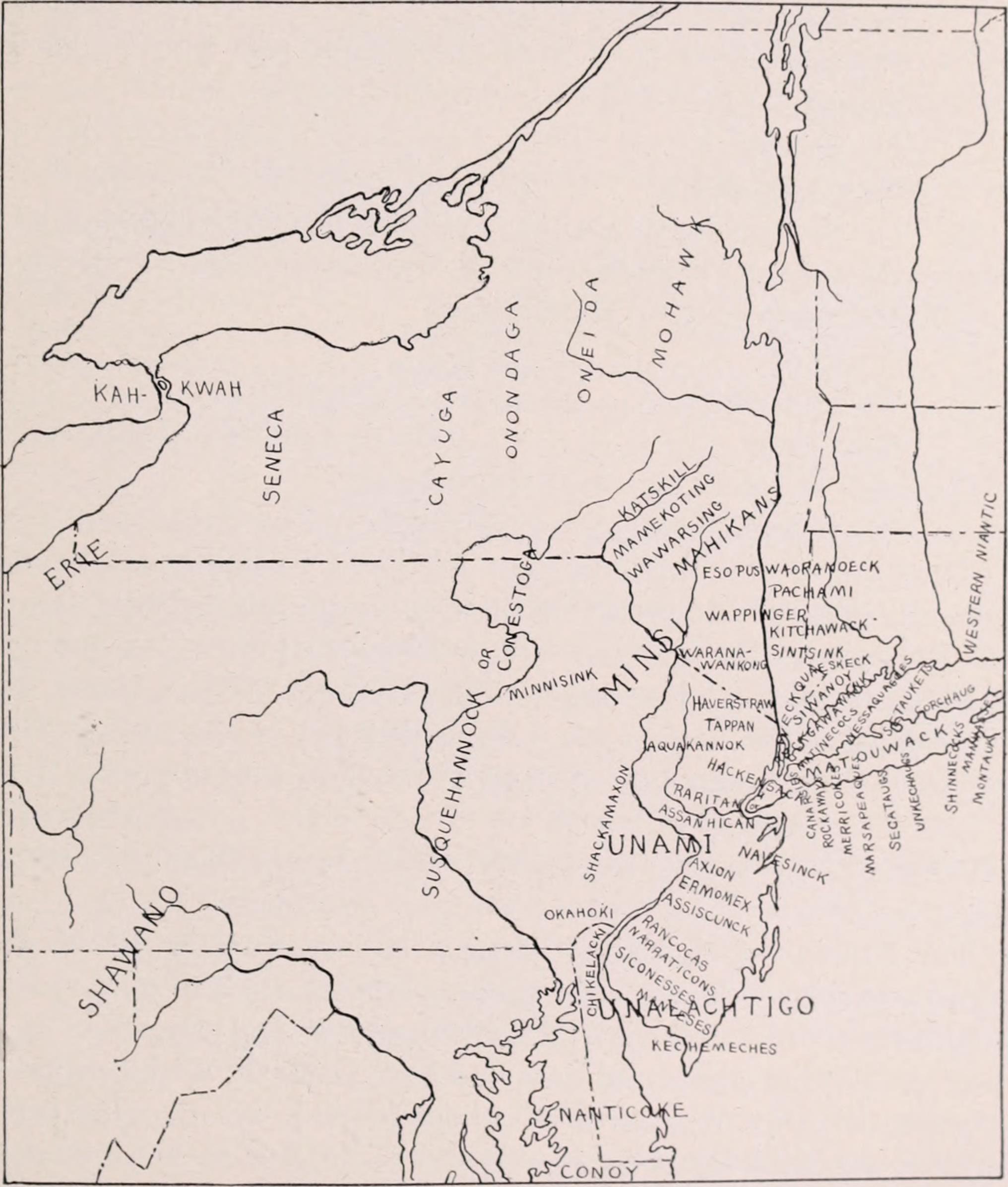
The earliest life of Croton Point belongs to the Kitchawank, a band of the Wappinger Confederacy who established a fortified village on the peninsula they called Navish. Louis A. Brennan's archaeological excavations in the early 1960s revealed shell middens — accumulations of Virginia oyster shells, animal bones, stone tools, and pottery — dating to approximately 5000 BC (Brennan 1962, NYSAA Bulletin No. 26). Among the finds were fragments of Vinette I pottery, the earliest ceramic tradition in the Northeast, found "in stratigraphic midden position" — meaning it was layered within the shell deposits in a way that confirmed its age (Brennan 1962).
The Kitchawank chose the point for the same reasons every subsequent occupant would: it was defensible, surrounded by water on three sides, with rich fishing grounds in the Hudson and the Croton River. The low-lying meadow at the base was called Senasqua — a name that, remarkably, would survive into the colonial legal record and beyond.
J. Thomas Scharf, in his 1886 *History of Westchester County*, described the Kitchawank presence: "The Kitchewonks had two important villages, — one where Peekskill now stands, called Sackhoes, and the other upon Van Cortlandt's Neck, connecting Senasqua or Croton Point with the main land. Here they had a strongly-built stockade which overlooked the waters of Haverstraw Bay, and guarded important oyster-beds there" (Scharf 1886, chunk 3987).
In August 1645, after the catastrophic Kieft's War had cost over 1,500 indigenous lives, the Kitchawank signed a peace treaty with the Dutch at Croton Point. A commemorative plaque marks the treaty site today. Within a generation, the Kitchawank would sell the point itself.
Second Life: The Colonial Purchase (1682)
On June 3, 1682, the Kitchawank sold Croton Point to Cornelius Van Bursum. Scharf transcribed the deed: "that neck or parcel of land, with the marsh, meadow ground, or valley thereto adjoining and belonging, situate, lying, or being, on the east side of the North or Hudson's River... commonly called and known by the name of Slauper's Haven, and by the Indians Navish, the meadow being by the Indians called Senasqua, being bounded by the said river and a certain creek called or known to the Indians by the name of Tanracken and Sepperack" (Scharf 1886, chunk 3989).
The deed is remarkable for preserving four indigenous place-names in a single legal instrument: Navish, Senasqua, Tanracken, and Sepperack. Each named a specific feature of the landscape — the point, the meadow, and two creeks — fossilizing a geography that had been established thousands of years before the Dutch arrived.
"At a very early period William and Sarah Teller occupied the peninsula, which became known from them as Teller's Point" (Scharf 1886, chunk 3989). The Tellers operated an Indian trading post on the point. Bolton adds that "the point or peninsula, the northern chop of the bay or entrance into Croton River, the Skippers call Slauper's Haven" (Bolton 1848, chunk 1317).
Third Life: The Underhill Vineyards (1827–1880s)
In 1827, the physician Richard T. Underhill began planting grapevines on Croton Point. Robert Bolton, visiting in the 1840s, described the scene: "The southern declivities of the Point towards the Croton Bay are covered with extensive vineyards of Catawba and Isabella. The whole of the latter cover nearly an area of forty acres. Two thousand one hundred and fifty vines have been planted" (Bolton 1848, chunk 1441).
By the 1860s, Underhill had expanded to 75 acres and developed two new hybrid grape varieties: the Croton and the Senasqua — the latter named for the Kitchawank meadow recorded in the 1682 deed (chunk 823, crotonhistory.org). Contemporary horticulturist H.E. Hooker praised the Croton grape as "certainly one of the most delightful grapes...that I have ever raised" (chunk 823). Underhill's operation was called "the first large vineyard in the country" (chunk 823).
The vines grew in soil that held five-thousand-year-old pottery shards. The winemaker named his finest variety after a word the Kitchawank had used for the same ground.
Fourth Life: The Brickyard (1880s–1900s)
When the vineyards declined — victims of phylloxera, changing tastes, and competition — the Underhill family turned to the point's other natural resource: its deep deposits of clay.
The Underhill brickyard operated from the 1880s into the early 1900s. "William A. Underhill's brickyard" produced bricks that were loaded onto barges and shipped down the Hudson to build New York City (crotonhistory.org, "Bricks on the Beach"). The same family worked the same land for an entirely different purpose. Fragments of Underhill bricks — some stamped with the family name — still wash up on the point's beaches.
The brick era also brought industrialization to a landscape that had been agricultural for sixty years and indigenous for millennia. Clay pits scarred the terrain. Kilns filled the air with smoke. The pastoral vineyards that Lossing had sketched in the 1850s gave way to an industrial operation that consumed the land rather than cultivating it.
Fifth Life: The Landfill and Restoration (1927–Present)
The fifth life was the most destructive. In 1927, Westchester County began using Croton Point as a municipal landfill. For nearly six decades — until the dump closed in 1986 — garbage was piled on ground that held Kitchawank artifacts, Underhill brickwork, and vineyard rootstock (Wikipedia, chunk 728).
The landfill eventually covered a significant portion of the peninsula. Environmental concerns mounted. The Croton Point Landfill Review of 2019 documented the toxic legacy and the remediation process. After closure, the site underwent a long process of capping and environmental restoration.
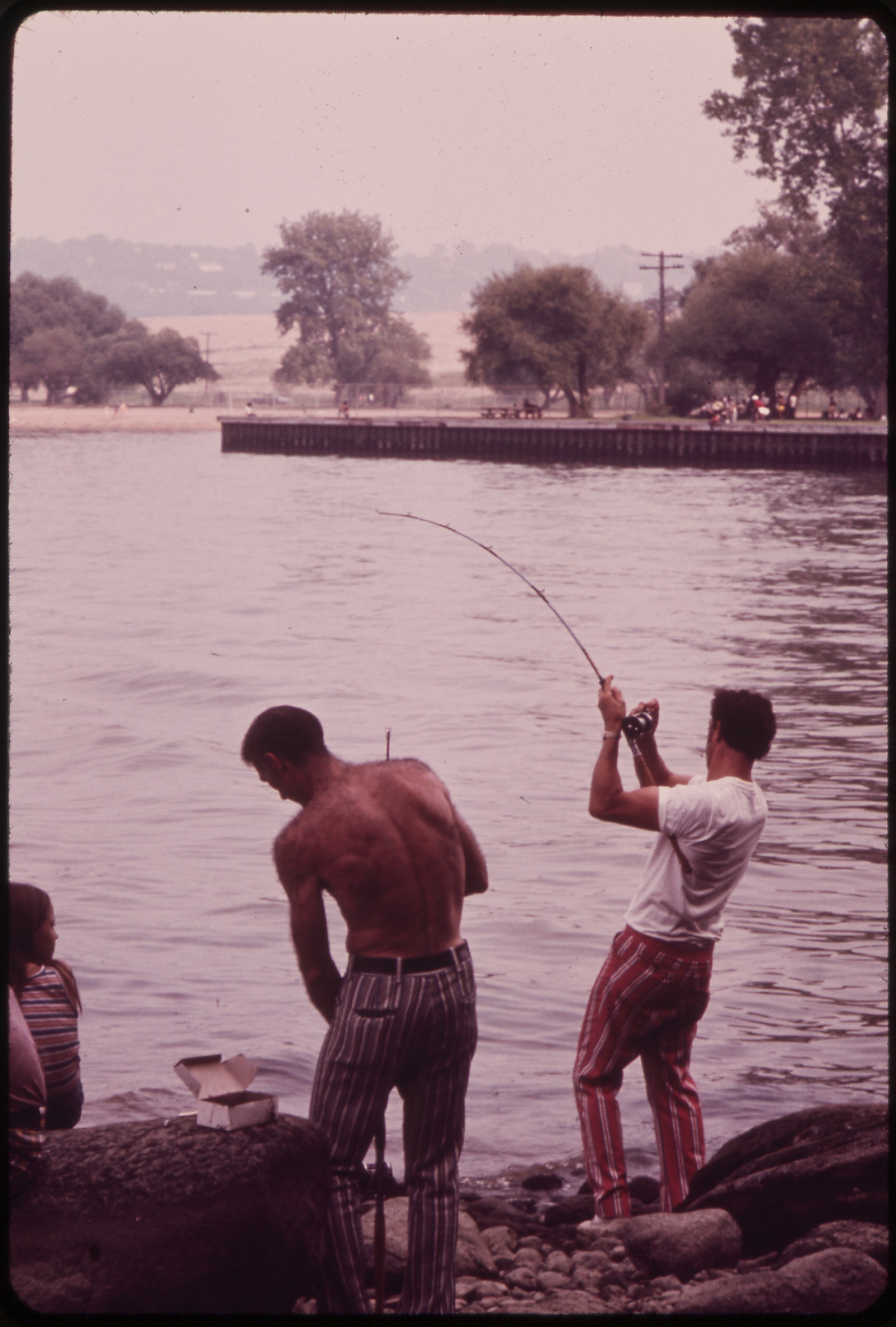
Today, Croton Point is a 508-acre county park operated by Westchester County. A nature center on the grounds houses archaeological collections from Brennan's excavations. Hikers walk trails that cross capped landfill cells, pass old brickyard foundations, and skirt the meadow once called Senasqua. An annual archaeology day, organized by the Louis A. Brennan Lower Hudson Chapter of the New York State Archaeological Association, demonstrates stone tool knapping and excavation techniques on the ground where the original tools were made.
The Palimpsest
The five lives of Croton Point are not stacked neatly — they are tangled together, each era's remains mixed into the soil of the next. A single shovel cut might pass through landfill debris, brick fragments, vineyard soil, colonial-era fill, and a shell midden seven thousand years old.
That is what makes Croton Point not merely a park but a document — a record of everything that has happened on one small piece of the Hudson Valley, written in clay and shell and trash and vine. The Kitchawank name Senasqua survived through a 1682 deed, a grape variety, and a conservation area. The name Navish survived through the archaeological record. The peninsula itself survived everything that was done to it — fortress, farm, factory, dump — and became a park where you can stand on capped garbage and look out at the same view of Haverstraw Bay that the Kitchawank guarded from their stockade.
Sources Consulted
- Brennan, Louis A. NYSAA Bulletin No. 26 (1962) — shell middens, Vinette I pottery
- Scharf, J. Thomas. *History of Westchester County* (1886), chunks 3987, 3989 — Kitchawank villages, 1682 deed
- Bolton, Robert Jr. *History of the County of Westchester* (1848), chunks 1317, 1441 — Teller's Point, vineyard description
- "The Grape King of Croton Point," crotonhistory.org (chunk 823) — Underhill vineyards, Senasqua grape
- "Croton in the 1850s," crotonhistory.org (chunk 963) — Lossing's firsthand account
- "Bricks on the Beach," crotonhistory.org — Underhill brickyard
- Wikipedia, "Croton Point Park" (chunk 728) — landfill dates, park acreage
- *Croton Point Landfill Review*, Westchester County, 2019
All direct quotes are verbatim from the cited sources. Each factual claim was verified against the Croton Historical Archive database.